Last Updated: July 4, 2026 | By E3 Aviation Editorial Team
Wind shear is the invisible weather hazard that turns a stable approach into a survival exercise. It doesn’t announce itself on a scan of the sky. It shows up as a sudden airspeed loss. Or a sink that doesn’t respond to the yoke. Or a wing that drops on short final and won’t come back with rudder alone. And it happens most often on two flight phases: approach and departure. Both are where you have the least altitude to trade for airspeed.
This is the 2026 GA field guide to wind shear. What it is. How to see it coming. What the signatures look like from the left seat of a piston single. And the escape technique every GA pilot should have rehearsed cold. We’ll skip the airline-training-manual tone. We’ll stick to what actually helps you on a Saturday afternoon into a summer convective airport.
What Wind Shear Really Is (and Why the Word Matters)
Wind shear is any sharp change in wind speed or direction over a short distance. It can be horizontal, vertical, or both. The FAA definition in AIM 7-1-23 covers Low-Level Wind Shear. Any encounter within 2,000 feet AGL counts. That’s the altitude band that matters most for GA operations. Above that, shear is uncomfortable. Below that, it can be fatal.
The reason the word matters: pilots use it loosely. A gusty crosswind isn’t shear. A thermal bump on climb-out isn’t shear. Wind shear is a step change. A distinct before-and-after in the air mass your airplane is flying through. When you get 15 knots of airspeed loss in a second and a half, that’s shear. When the ball swings hard and the nose yaws without input, that’s shear. Learning to feel the difference is half the skill.
Why Wind Shear Owns the Approach and Departure Windows
On approach you’re low, slow, configured, and committed. On departure you’re at Vx or Vy, gear coming up, flaps retracting, engine at redline. Neither is a good place to lose 20 knots of airspeed or gain 800 fpm of downdraft. Both are precisely where wind shear lives.
Three physical realities pile on. First, the boundary layer — the lowest 2,000 feet of the atmosphere. It’s where surface friction, thermal mixing, and convective outflow all collide. Second, thunderstorm outflow spreads horizontally along the ground for miles beyond the cell itself. That’s why “the storm is over the field, not near me” is dangerous self-talk. Third, GA piston singles are light enough to be tossed by shears that a Boeing 737 would shrug off.
That’s the honest math. It also explains the NTSB’s low-altitude weather accident file. The base rate holds steady, and better cockpit avionics don’t shrink it much. The information reaches the pilot fine. The airplane doesn’t have the excess energy to buy back the mistake.

The Three Wind Shear Signatures Every GA Pilot Should Recognize
Not every shear looks the same. But three signatures cover the vast majority of what a GA pilot will meet. Know the fingerprint of each one.
Microburst outflow
The classic thunderstorm-generated shear. A microburst is a concentrated downdraft — up to 6,000 feet per minute. It hits the ground and fans outward as a radial gust front. The FAA’s pilot wind shear guide (AC 00-54) documents peak outflow speeds up to 45 knots. The full life cycle from formation to dissipation runs about 5 to 15 minutes. That’s the trap. It’s brief. But fly through the middle on short final and you’ll see 30-plus knots of headwind. Then 30-plus knots of tailwind. All in the span of a mile.
The onset signature: airspeed rises sharply, then falls sharply, and the vertical speed goes from level to a strong sink. If you’re low, that’s exactly the wrong combination.
Frontal passage shear
When a cold front rolls through, the temperature drops and the wind veers. The boundary between the two air masses can produce a distinct shear layer. It’s usually less violent than a microburst. But it can last for hours and cover a much larger area. On approach, you’ll feel it as a wind direction change and a change in descent rate. It’s the shear that shows up on the METAR trend but doesn’t necessarily trigger an LLWAS alert.
Terrain and temperature inversion shear
The one that catches people who don’t fly in the mountains often. When a cold layer sits under a warmer layer overnight, the wind above the inversion can be blowing 30 knots. Meanwhile the surface is dead calm. Climb through the inversion and the aircraft suddenly meets the upper wind. It doesn’t have to be dramatic. A 20-knot shear at 500 AGL on climb-out spikes the VSI. It gives you a quiet second of “what just happened.” Backcountry strips in Idaho, Colorado, and the Pacific Northwest see this constantly at sunrise.
What Shear Recognition Looks Like From the Left Seat
Instrument cues first, because that’s what pilots trained on. On a stabilized approach at 1.3 Vso, watch four indications:
- Airspeed swing of 10+ knots in under 3 seconds, in either direction. The direction doesn’t matter as much as the rate. A sudden 15-knot gain is a warning. The corresponding loss on the far side of the shear is coming.
- VSI change of 500+ fpm without a control input. Especially a shift from your target descent rate to a growing sink.
- Ball out of center with no rudder input. Directional shear will yaw the nose. Fighting it with rudder makes coordinated-airplane instincts fight you.
- Groundspeed vs. indicated airspeed divergence. Modern EFIS with a groundspeed readout gives you a second data point. If IAS drops but groundspeed holds, that’s a rising tailwind. If IAS holds but groundspeed climbs, that’s a rising headwind.
Then the tactile cues. The airplane feels lighter or heavier suddenly. Engine sound changes because the load on the prop changes. The airframe rumbles differently. A pilot who’s flown the same 172 for 400 hours will feel this before the airspeed needle catches up. If your gut says “that wasn’t a normal bump,” believe it.
The Recovery Technique Nobody Practices Enough
Here’s the punchline, and it’s not intuitive. If you get caught in low-altitude shear on approach, you do not chase the airspeed. You firewall the throttle. You pitch for max climb angle. And you accept the airspeed you have. This is the opposite of what your instrument scan is trained to do.
The full recovery sequence, drilled the way transport-category pilots drill it:
- Maximum thrust immediately. Full throttle, mixture rich, prop full forward. Don’t overthink the sequence — get power. In a piston single you might have 200 horsepower to work with. Every one of them counts.
- Pitch to the shaker or to the initial climb attitude, whichever is more aggressive. In an airplane without a stick shaker, pitch to your initial climb attitude and trust the airplane. Overpitching beats under-pitching here. The airspeed will bleed back as you climb out of the affected air mass.
- Do not retract flaps or gear until you’re clear of the shear. Configuration changes at low altitude in shifting air make bad situations worse. Fly what you brought in.
- Ride it out. The shear is a spatial event. You’re flying through it, not into it. Hold max thrust and best-climb pitch until the airspeed stabilizes and the VSI shows a positive number that doesn’t reverse.
- Then, and only then, declare intentions. Divert, hold for the cell to pass, or re-set for another approach. Talk to ATC. Get a PIREP into the system for the next pilot.
Our take: this technique is easier to describe than to do. In the sim it takes most GA pilots two or three runs to stop chasing the airspeed. Only then do they commit to the pitch attitude. If you have access to a simulator, spend an hour on it. Nothing else you can practice in ground school pays off as directly.
Shear Advisories: LLWAS, TDWR, ATIS, PIREPs
The good news is that the ground network is better than most GA pilots realize. Four systems feed you wind shear intel if you know where to look.
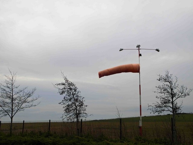
LLWAS (Low-Level Wind Shear Alert System) is a network of anemometers around large airports. It detects wind speed and direction differences at the surface. When a difference of 15 knots or more shows up across the network, ATC calls a “shear alert” on tower frequency. The affected runway is named. Roughly 40 towered airports in the U.S. have LLWAS coverage.
TDWR (Terminal Doppler Weather Radar) covers about 45 U.S. airports. It detects shear aloft, not just at the surface. TDWR alerts feed the tower controllers’ displays. A “microburst alert” from tower on a summer afternoon is a TDWR call. It should end the conversation. Go around, hold, or divert.
ATIS and AWOS wind averages hide shear. A one-minute average of 12 knots can mask 5-knot lulls and 25-knot gusts. When you read the ATIS, mentally add the peak gust to your speed math and subtract the lull. If the gust factor exceeds 15 knots, treat the approach as shear-suspect whether or not it’s called out.
PIREPs are the single best real-time source of GA-relevant shear intel. A PIREP that reads “moderate turbulence on final, 500 AGL, gained 15 then lost 20” beats any forecast. If you catch a shear on your own approach, file a PIREP the moment you’re clear. It’s a two-minute call. It might save someone.
Preflight Discipline — How to Decide Not to Go
The best wind shear recovery is the one you never had to fly. Three preflight questions filter out most shear encounters before you get in the airplane.
First, is convection in the forecast within 20 nm of your destination during the approach window? Any TS on the TAF is a yellow flag. So is any convective SIGMET in the corridor, or any building cumulus visible on the way. Convective outflow travels — 15 to 20 miles from the parent cell is common. A thunderstorm 15 nm south of the field at 3 pm can put a microburst on the approach end at 3:15.
Second, what does the gust factor look like on the surface obs? A wind of 15G28 at destination on approach changes the risk calculus. Especially with a temperature spread suggesting instability. That’s not a shear guarantee. But the atmosphere is telling you it’s mixing energetically at the surface.
Third, what’s the terrain and thermal setup? Mountain airports at sunrise and sunset routinely produce inversion shear that’s not on any TAF. Desert airports on hot summer afternoons produce dry microbursts. Those are outflow events with virga aloft and dust plumes at the surface, but almost no visible rain. Both setups are shear factories that don’t advertise.
Honestly, this is where we’d push back on the “GA pilots can handle summer weather” narrative. You can. But the way you handle it is by choosing your window, not by out-flying the shear. If the numbers say “go two hours earlier or three hours later,” go two hours earlier. The airplane doesn’t care what time you launched. The passengers you brought home care very much that you did.

Departure Shear: Same Physics, Less Warning
Approach shear gets the training-manual attention. But departure shear kills too. On climb-out at Vy you’re at max continuous power, pitched high, drag-configured. You have almost no altitude to trade. A 20-knot headwind loss at 300 AGL costs about 40 feet of altitude buffer instantly. The airplane feels like it hit a soft wall.
The departure technique is the same as approach. Maximum power. Pitch to the shaker or initial climb attitude. Don’t reconfigure until clear. The difference is you have even less time to decide. The signature is the same: sudden airspeed loss or gain, yaw with no input, VSI going wrong. If you feel it on departure, commit to the pitch attitude immediately. Don’t reason about it.
One tactical note that’s saved GA pilots repeatedly. On any suspect-shear takeoff, brief a specific “abort altitude” before you release the brakes. If the airspeed hasn’t stabilized above target by, say, 500 AGL, you land straight ahead if runway remains. Or you pitch for max climb angle and ride it out. The decision is pre-made. You don’t waste seconds negotiating with yourself in the moment.
What We’d Do Differently in a Piston Single Today
We’ll be straight with you: most piston-single pilots have never practiced a real wind shear recovery. It’s not in the private syllabus. It’s not on the commercial checkride. It shows up as one bullet in the AC 00-54 handout that most instructors mention in passing.
That’s a training gap. Fix it in three ways.
Book one hour of sim time. Fly six microburst-on-final scenarios with a good instructor. Different weights, different runways, different gust factors. Learn what “commit to the pitch attitude” feels like when the airspeed needle is unwinding. That’s when every instinct says pull the nose down.
Read AC 00-54, the FAA’s Pilot Wind Shear Guide. It’s old — original 1988, updates through the 2000s. But the physics haven’t changed, and the technique guidance is still the reference standard. It’s a 100-page read. The executive summary and the recovery-technique section are the parts you should almost memorize.
Debrief every gusty-day approach with yourself. Not just “that was bumpy.” Actually reconstruct the airspeed swings, the VSI excursions, the yaws. Build the pattern-recognition library. Next time real shear hits, your response comes from muscle memory instead of analysis.
Wind Shear FAQ for GA Pilots
How much airspeed loss counts as a wind shear encounter?
The FAA operational definition sets a clear threshold. 15 knots of airspeed change in three seconds or less counts as “significant” low-altitude shear. In practice, treat any airspeed excursion of 10 knots or more as shear-suspect. Unless it’s clearly your control input. Prompt a mental “am I still stabilized?” check.
Do dry microbursts really exist?
Yes. They’re more common than pilots realize in the desert Southwest and high plains during summer. A dry microburst is an intense outflow from a high-based cumulus or virga column. The rain evaporates before reaching the ground. You won’t see rain on the radar picture, but you’ll feel the outflow. Dust plumes rising at the surface without a visible weather system are the classic ground-truth signature.
Can wind shear be forecast reliably?
Not with the precision pilots would like. Convective outflow shear is forecast probabilistically by the SPC and NWS. That happens via convective SIGMETs and Terminal Aerodrome Forecasts. Frontal shear is forecast through synoptic-scale products. Terrain-and-inversion shear is essentially unforecast on any public product. Real-time detection via LLWAS, TDWR, and PIREPs is where the actionable intel lives.
Related E3 Articles
- Stabilized Approach and Landing: GA Safety Standard
- Thunderstorm Avoidance: The Complete GA Pilot Guide 2026
- Crosswind Landing Mastery: A GA Pilot Technique Guide
- Stall Recognition and Recovery: A GA Pilot’s 2026 Guide
- ATIS vs AWOS vs ASOS: The 2026 GA Pilot Field Guide
- Reading PIREPs: The 2026 GA Pilot Field Guide
- Airborne Weather Radar for GA Piston Owners: The 2026 Field Guide
- Lightning Detection for GA Pilots: The 2026 Stormscope Guide
�������������������������������������������������������������������������������������������������������������������������������������������������������������������������������������������������������������������������������������������������������������������������������������������������������������������������������������������������������������������������������������������������������������������������