
Last Updated: May 14, 2026 | By E3 Aviation Editorial Team
If you’ve ever scrolled an aviation feed and thought “I want to fly that,” chances are you were looking at Idaho. The state holds more public-use idaho backcountry airstrips than anywhere else in the lower 48, and most of them sit inside the largest contiguous wilderness in the country. The catch is that none of these strips suffer fools. The terrain is real, the density altitude is real, and the go-around options are sometimes nonexistent. This guide breaks Idaho down by skill tier, walks the specs on the eight strips that matter most, and tells you exactly what to fly and how to build up to the wilderness pieces without scaring yourself or your airplane.
Why Idaho Is the GA Pilot’s Backcountry Capital
Idaho is the only state in the country that actively maintains a public network of backcountry airstrips as part of its transportation infrastructure. The Idaho Division of Aeronautics manages more than 30 of them, scattered across river canyons, alpine meadows, and the edges of the Frank Church-River of No Return Wilderness. That’s not a marketing line. The state employs caretakers at the busiest strips during the summer.
For a GA pilot, that infrastructure matters. It means published standard operating procedures, real runway maintenance, and a community of pilots who’ve been flying these strips for decades. You don’t get that in most of the West.
The idaho backcountry airstrips network covers everything from a 30-minute hop out of Boise to a one-way wilderness approach where a missed approach simply isn’t on the table. The variety is the point. You can build up.
Before You Land: The Idaho Backcountry Skills Stack
Don’t show up to Idaho expecting to wing it. The strips that look easy in YouTube videos are flown by pilots with hundreds of hours of mountain time. The pilots making it look hard are usually the ones who just got humbled.
Here’s the honest stack of skills you need before flying these idaho backcountry airstrips:
- Real mountain training. Take a recognized mountain flying course before you go. McCall Mountain/Canyon Flying and Mountain Canyon Flying Seminars both run multi-day programs out of Idaho. A weekend with a CFI who really flies the backcountry beats a year of YouTube research.
- Density altitude discipline. Summer DA at Johnson Creek can push 8,000 feet. Smiley Creek routinely sees 10,000+ feet on a July afternoon. Your performance charts aren’t suggestions, and the runway you eyeball at sea level looks very different at altitude.
- Short and soft-field proficiency. If you’re not landing your airplane at book numbers at your home field, you’re not landing it short in Idaho. Practice both ends of the takeoff and landing distance chart.
- Tailwheel time helps, but it’s not required. Most of the popular strips take nosewheel aircraft just fine. The wilderness strips are a different conversation.
- Weather literacy. Canyon winds, valley fog, afternoon convective build-up — Idaho’s weather changes by the hour. Get good at reading mountain weather before you commit to a fly-in.
The good news: a typical private pilot with about 200 hours, real mountain training, and conservative go/no-go discipline can fly the starter tier of idaho backcountry airstrips and have a phenomenal time. For more on the foundations, our backcountry flying techniques guide walks through the core technique stack pilot-to-pilot.
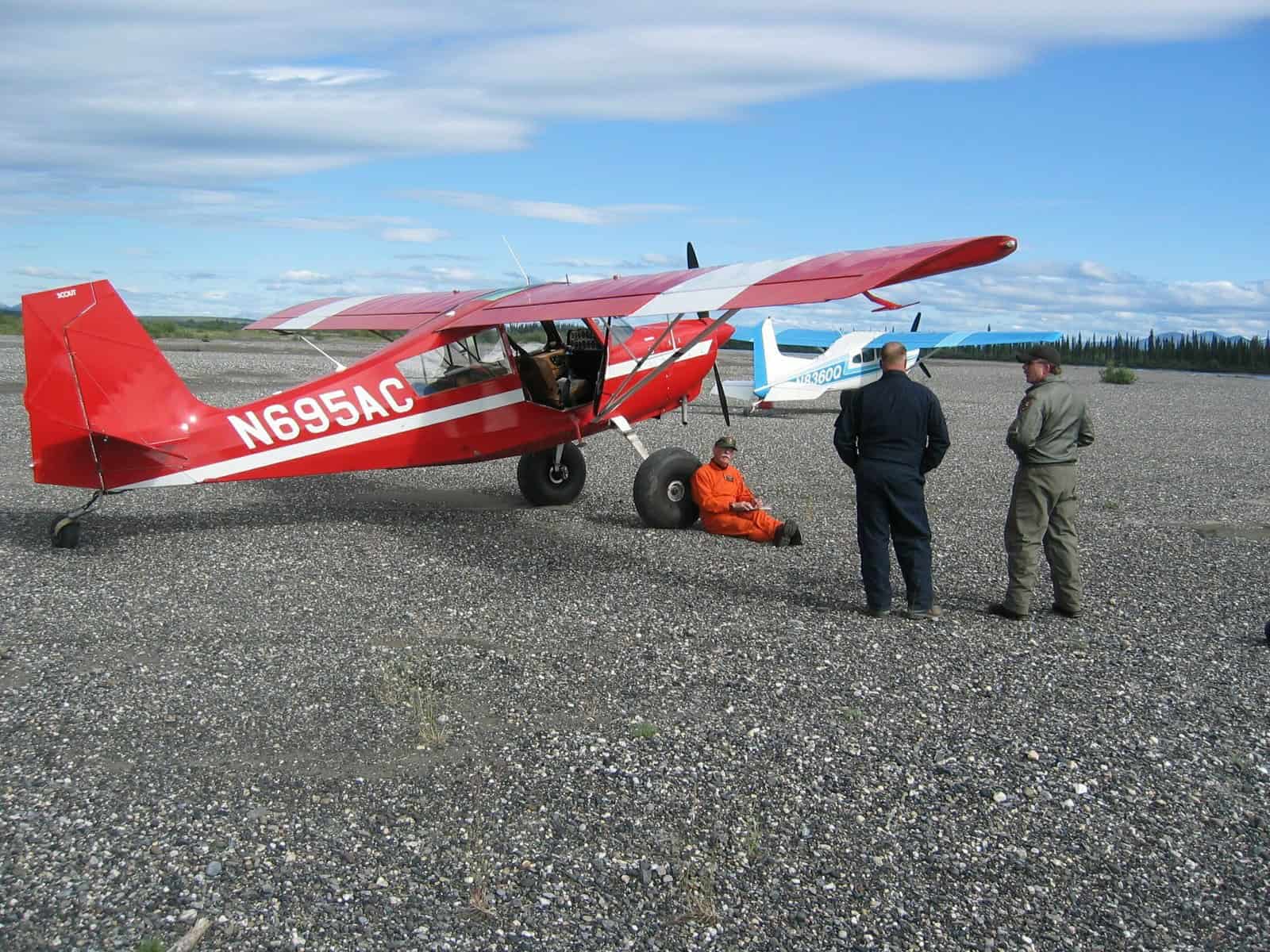
Starter Strips: Where Mountain Pilots Earn Their Wings
These three idaho backcountry airstrips are the on-ramp. Long-ish runways, manageable terrain, paved or smooth turf surfaces, and access to fuel and services within reasonable distance. None of them are easy in the airliner sense. But they’re survivable for a competent GA pilot with mountain training.
Garden Valley (U88) — The Half-Hour-From-Boise Gateway
Garden Valley sits at 3,177 feet MSL, about 30 minutes northeast of Boise. The runway is roughly 3,855 feet of grass, nestled between two ridges in a wide valley. Density altitude is the easiest of the popular strips because the elevation is low. The valley is wide enough that the approach feels like flying into a real airport — just one with cows in the next field.
Garden Valley is where most Idaho first-timers start, and for good reason. You can fly out of Boise (KBOI), land for breakfast, walk to town, and be back home before lunch. The strip handles everything from a Cub up to a 182 or 206 with normal mountain procedures.
Smiley Creek (U87) — Long Runway, Real Density Altitude
Smiley Creek is the high-altitude classroom. The field elevation is 7,160 feet, and the turf runway is 4,900 feet long and 150 feet wide. On paper that’s enormous. In a summer afternoon with a density altitude pushing 10,000 feet, that long runway becomes the only reason your airplane gets airborne again.
The strip sits at the south end of the Sawtooth Valley, and the scenery is the kind of thing you put on the cover of a magazine. There’s a lodge, a café, and a paved highway nearby — meaning fuel, food, and an out are all within reach. Smiley Creek is the strip where you go to learn what high-DA actually feels like, with enough runway that you’ll get away with a bad rotation if you’ve done your math.
Cavanaugh Bay (66S) — North Idaho’s Lakeside Strip
Cavanaugh Bay is the outlier on this starter list because it’s not in the central mountains. It’s in the panhandle, on the east side of Priest Lake. The elevation is 2,484 feet and the turf runway is 3,100 by 120 feet. The terrain is forested rather than alpine, the weather is more maritime than continental, and the approach is gentle.
What makes Cavanaugh Bay worth the trip: it’s a lakeside camping destination with a public-use strip that handles most piston singles. The state runs the field, the turf is maintained, and the lake is right there. If you want a backcountry-feeling fly-in without committing to the Frank Church wilderness, this is where you go.
The Crown Jewels: Idaho’s Iconic Backcountry Destinations
These are the idaho backcountry airstrips that show up in every Idaho backcountry article ever written. They earned the reputation. Both demand more aircraft performance, more pilot proficiency, and more weather discipline than the starter tier — but neither is wilderness-level commitment.
Johnson Creek (3U2) — The Cadillac of Backcountry
Johnson Creek is the most famous airstrip in the Idaho network and probably in the lower 48. Field elevation is 4,960 feet. The turf runway is 3,400 by 150 feet, with an additional 100 feet of takeoff length on the 35 end. The published procedure: land 17, depart 35, regardless of wind unless conditions absolutely demand otherwise.
Why? Rising terrain to the south means a go-around on runway 17 is genuinely hazardous. You commit on final, you land. There’s no missed approach in the traditional sense. The pattern is non-standard, the radio chatter is constant in summer, and the campground is the social hub of the entire Idaho backcountry community.
The facilities are something else. Free camping, bathrooms, hot showers, electricity, Wi-Fi, potable water, fire pits, and a van that runs to Yellow Pine for groceries. Compared to true wilderness strips, Johnson Creek is luxury. That’s exactly why it works as a base camp — fly in for a long weekend, do day trips to the harder strips, sleep under a wing.
Big Creek (U60) — The Year-Round Hub
Big Creek sits at 5,743 feet MSL, with a 3,550-by-110-foot turf runway oriented roughly east-west. The runway has about 3% upslope to the west, which makes the operating procedure straightforward: land 19 (uphill to the west), depart 01 (downhill to the east). Even with a tailwind on landing or a headwind on departure, the slope dominates the decision.
What makes Big Creek different from Johnson Creek is the lodge. Big Creek Lodge was rebuilt in 2013 as a nonprofit partnership between the Idaho Aviation Foundation and the Payette National Forest. It’s open to pilots and the general public year-round. That “year-round” matters — most Idaho backcountry strips close or become unusable in winter. Big Creek with its lodge and proximity to the wilderness becomes the staging point for adventurous winter flying when other strips are buried.
Approach considerations are real here. The valley is tighter than Johnson Creek, the runway slope is unusual, and the terrain around the strip is unforgiving. This is where most pilots make the jump from “starter backcountry” to “real backcountry” — and where careful procedure separates the comfortable from the white-knuckled.
Wilderness Strips: When You’re Ready for the Frank Church
Here’s where the idaho backcountry airstrips network gets serious. The strips inside the Frank Church-River of No Return Wilderness are managed by the U.S. Forest Service rather than the state, the runways are shorter and rougher, and the surrounding terrain makes go-arounds either dangerous or impossible. Don’t fly these until you have the hours, the airplane, and the mountain time.
Soldier Bar (85U) — One-Way Into a Bar Above the River
Soldier Bar sits 500 feet above Big Creek on a bench in the canyon wall, at an elevation of 4,190 feet. It’s roughly 6 nautical miles west of Cabin Creek and about 3 miles west of where Big Creek joins the Middle Fork of the Salmon River. The runway is short, narrow, and unforgiving.
The strip is public use as of 1988, when the Forest Service requested re-designation. But “public use” doesn’t mean recreational pilots should treat it like Garden Valley. The approach is committed, the terrain is unforgiving, and the strip itself is barely a strip. This is a destination for pilots with serious backcountry experience flying Super Cubs, Husky, XCub, Carbon Cub, or 180-class aircraft that can stop in 500 feet on a bad day.
Cabin Creek (108) — The Go-Around-Impossible Approach
Cabin Creek is one-way, dirt and turf, at an elevation of 4,289 feet. The Forest Service manages the field, and the approach geometry simply doesn’t allow a missed approach. You commit, you land. Period.
The strip provides access to fishing on Big Creek and to big-game hunting in the surrounding hills. Like Soldier Bar, it requires real backcountry experience and the right airplane. The Forest Service’s published airstrip management plan is explicit: instruction in proper approach procedures is needed before you fly in. That’s not lawyer language. Pilots who didn’t take that seriously have left wreckage in those hills.
Standard Operating Procedures: What Idaho Actually Requires
The Idaho Division of Aeronautics publishes formal Standard Operating Procedures for the busiest idaho backcountry airstrips. These aren’t optional reading. They cover:
- Pattern altitude and direction (not standard — often dictated by terrain rather than wind)
- Landing and departing runway preferences (often one-way regardless of wind)
- Density altitude considerations and recommended weight limits
- Common hazards: rising terrain, turbulence zones, wildlife on the runway
- Camping rules and noise sensitivity for neighboring communities
- Frequencies, including the unicom protocols that Idaho pilots actually use
The SOPs are free. They’re online at the Idaho Transportation Department site, and Idaho Aviation Association republishes them. Reading them before you fly is the bare minimum. Print them. Stash them in your kneeboard. That’s how Idaho pilots roll.
For the broader rules that govern off-airport and bush-strip flying, check our off-airport landing legality guide — the FAR background matters even at developed state-managed strips, especially in wilderness areas where the Forest Service has its own overlay.
The Aircraft That Make Sense in the Idaho Backcountry
You can fly idaho backcountry airstrips in just about anything from a Carbon Cub to a Bonanza. What changes is which strips you can fly into safely. Here’s the honest matrix:
Cessna 172 / Cherokee 140 / Cherokee 180. Garden Valley, Smiley Creek (with caution on hot afternoons), Cavanaugh Bay, and Johnson Creek (with proper procedure). Big Creek is doable but tight on a hot day. Wilderness strips are out unless you’ve got serious short-field skill and the right loading. Our complete Cessna 172 pilot guide covers the variant-by-variant useful load math that matters for Idaho work.
Cessna 182 / 185 / 206. Everything in the starter and crown jewel tiers, plus the easier wilderness strips with experienced pilots. The 185 and 206 on bush tires have been the workhorses of the Idaho backcountry for decades.
Super Cub / Husky / XCub / Carbon Cub. Everything. These are what the wilderness strips were built for. Short takeoff and landing distances measured in feet rather than hundreds of feet. Bush tires, big flaps, and the kind of low-speed handling that makes a 1,000-foot strip feel routine.
Cirrus, Bonanza, Mooney. Stick to the paved strips and the easiest of the developed turf strips. These airplanes were not designed for short, soft fields. Some pilots do fly them in. Most regret the gear inspection afterward.
Pack-Out Planning: Camping, Fuel, and Weather
The logistics of an Idaho fly-in matter more than most pilots expect.
Fuel. Most idaho backcountry airstrips have no fuel. Plan to fly in with enough fuel to fly out and divert. McCall (KMYL), Cascade (U70), and Salmon (KSMN) are the practical fuel stops around the central mountain network. In the panhandle, fuel is more accessible — Coeur d’Alene (KCOE) and Sandpoint (KSZT).
Camping. Johnson Creek, Big Creek, Smiley Creek, and Cavanaugh Bay all support tent or under-the-wing camping. Bring a real sleeping setup. Nights at elevation get cold even in July, and afternoon thunderstorms are common. Cross-country airplane camping is its own discipline — pack like you’d pack for a wilderness backpacking trip, not a hotel weekend.
Weather. Idaho mountain weather follows a hard pattern in summer: clear, smooth mornings; convective build-up by early afternoon; thunderstorms by late afternoon. The cardinal rule is fly the morning. Be on the ground or out of the canyons by 1 p.m. local. The pilots who got into trouble in Idaho almost always did so in the afternoon.
Our take: build your trip around morning departures and evening fires, not afternoon adventures. The strips aren’t going anywhere. The weather window is.
How to Build Up to Idaho the Right Way
Here’s what most pilots get wrong: they treat the idaho backcountry airstrips network like a checklist of bragging rights. Land at Johnson Creek, post the photo, move on. That approach builds zero useful skill, and it puts pilots into Cabin Creek and Soldier Bar before they’re ready.
We’ll be straight with you: the right way to build Idaho is to take a recognized mountain flying course at McCall or Cascade, fly into Garden Valley a dozen times until the procedures feel routine, work up to Smiley Creek and Johnson Creek with a backcountry CFI on board, and only then start thinking about Big Creek. The Frank Church wilderness strips come after a full season of flying the easier ones.
If you’re newer to the discipline, our backcountry aviation getting-started guide walks through the training and mindset stack pilot-to-pilot. The pilots who do Idaho well treat it as a multi-year apprenticeship. The ones who treat it as a vacation often pay for that mistake with an insurance claim — or worse.
One more thing. The idaho backcountry airstrips network exists because pilots before us fought to keep it open. The Idaho Aviation Foundation, the Idaho Aviation Association, the Idaho Transportation Department — they spend real money and real volunteer hours maintaining these strips. Fly respectfully, follow noise abatement, donate when you can, and leave the strips better than you found them. The community is what protects this resource.
Frequently Asked Questions
Do I need a tailwheel endorsement for idaho backcountry airstrips?
No, not for most of the developed strips. Garden Valley, Smiley Creek, Cavanaugh Bay, Johnson Creek, and Big Creek all routinely see nosewheel aircraft like Cessna 172, 182, and Cirrus SR22. Tailwheel time helps in the rougher wilderness strips like Soldier Bar and Cabin Creek, where shorter ground rolls and bigger flap travel matter more. The bigger requirement is real mountain flying training, not the tailwheel endorsement itself.
Is a Cessna 172 enough airplane for Idaho?
For the starter tier and Johnson Creek, yes — with proper loading, conservative density altitude planning, and real short-field technique. A 172 at gross weight on a 95-degree July afternoon at Smiley Creek is a different airplane than a 172 at sea level. Plan for partial fuel, plan for morning operations, and stay off the wilderness strips. A 182, 185, or 206 gives you significantly more margin in Idaho.
What time of year is best for flying idaho backcountry airstrips?
Most of the strips are usable from late May through October, with peak season running mid-June through early September. Spring snowmelt closes the turf strips into May or even June some years. Fall is arguably the best window — cooler temperatures mean lower density altitude, the afternoon thunderstorms ease off, and the aspens turn gold against the dark conifers. Check NOTAMs and the Idaho Transportation Department site before any trip; conditions vary year to year.
Make E3 Aviation Association Part of Your Backcountry Journey
Idaho is the kind of flying that reminds you why you became a pilot. Real airplanes, real terrain, real consequences, and a community that’s been doing this for generations. The idaho backcountry airstrips network is one of the great GA resources in the country — and it’s only there because pilots use it, fund it, and protect it.
E3 Aviation Association exists for exactly this kind of flying. Adventure, ambassadors, ownership, and a community built by pilots for pilots. Our co-founder Trent Palmer has spent thousands of hours flying Idaho and the rest of the western backcountry. Our members include backcountry CFIs, bush plane builders, and pilots who’ve flown every strip on this list. Whether you’re working up to your first Garden Valley landing or planning your tenth Frank Church loop, this is your community.
Join E3 Aviation Association at e3aviationassociation.com — built by pilots, for pilots.
Sources and further reading:
