
Last Updated: June 3, 2026 | By the E3 Aviation Editorial Team
Most GA pilots can quote the name AIRMET Sierra and AIRMET Zulu. Fewer can tell you what triggers each one. Fewer still know how long they stay valid, or what changes when one upgrades to a SIGMET. That gap costs flights, and worse, it costs go/no-go judgment.
This guide walks through reading AIRMETs and SIGMETs the way an experienced GA pilot reads them. We’ll cover what each one means under FAA AIM 7-1-6. We’ll cover the trigger thresholds and the alphabetic naming on a brief. Then we’ll cover how to pull them in flight. We’ll also flag the traps that catch even instrument-current pilots.
If you’ve worked through our pieces on thunderstorm avoidance and structural icing in piston singles, this is the missing layer. The advisories are how you knew the storm or the ice was coming in the first place.
Why Reading AIRMETs and SIGMETs Matters More Than Pilots Admit
Reading AIRMETs and SIGMETs is the difference between flying into known forecast hazards and flying around them on purpose. The FAA writes both products specifically for pilots in flight. They’re not optional reading on a brief.
Per AIM 7-1-6, AIRMETs and SIGMETs are both inflight aviation weather advisories. AIRMETs flag conditions that may affect aircraft safety at intensities lower than a SIGMET. SIGMETs flag conditions that are expected to affect the safety of all aircraft. The threshold matters. So does what each one rules out.
We’ll be straight with you. If a SIGMET sits along your route in a Cessna 172 or a Cherokee, it’s not a go decision. If an AIRMET Zulu or AIRMET Sierra blankets your route, it’s a hard look at altitudes, alternates, and outs.
What an AIRMET Actually Is
AIRMET stands for Airmen’s Meteorological Information. It’s a concise text or graphical advisory of en route weather phenomena that may affect aircraft safety. Per AIM 7-1-6, AIRMETs are intended for all pilots. They’re especially aimed at VFR pilots and operators of sensitive aircraft. Read: single-engine piston pilots.
Reading AIRMETs and SIGMETs starts with the AIRMET because it’s the most common product you’ll see in a brief.
AIRMETs over the contiguous U.S. are issued on a scheduled basis every 6 hours at 0245, 0845, 1445, and 2045 UTC. Alaska runs every 8 hours. Hawaii runs every 6 hours. Unscheduled updates and corrections get issued as needed. They go out as both text bulletins and as graphical AIRMETs (G-AIRMETs).
The Seven Hazards an AIRMET Covers
AIRMETs over the contiguous U.S. flag seven distinct en route hazards:
- IFR conditions — ceiling below 1,000 feet and/or surface visibility below 3 statute miles
- Widespread mountain obscuration
- Moderate icing
- Freezing levels
- Moderate turbulence
- Non-convective low-level wind shear potential below 2,000 feet AGL
- Sustained surface winds greater than 30 knots
That last one catches GA pilots. A 30-knot sustained surface wind isn’t a SIGMET-level event. But it’s the kind of crosswind that ends in a ground loop on a short narrow runway.

The Three AIRMET Letters: Sierra, Tango, Zulu
The three AIRMET advisories you’ll see on the brief use phonetic letters as topic labels. Reading AIRMETs and SIGMETs requires knowing which letter covers which hazard.
AIRMET Sierra — IFR and Mountain Obscuration
AIRMET Sierra flags IFR conditions and extensive mountain obscuration. The IFR criterion is ceilings under 1,000 feet and/or visibility under 3 statute miles. The hazard must cover more than 50% of the area at one time. Mountain obscuration is its own line — clouds, precipitation, mist, fog, haze, or smoke hiding terrain.
For a VFR pilot, Sierra is a stop sign. For an IFR-current pilot, Sierra is a planning input. Alternate required. Lower-than-VFR ceilings. A possible ILS or LPV approach at the destination.
AIRMET Tango — Turbulence and Strong Surface Winds
AIRMET Tango covers moderate turbulence, sustained surface winds of 30 knots or greater, and non-convective low-level wind shear. The wind-shear note is recent and worth flagging. Even without a thunderstorm in the area, the AIRMET can warn you of shear conditions. The window is below 2,000 feet AGL on approach or departure.
Tango is the AIRMET most often dismissed by pilots who assume “moderate” turbulence is just bumps. It isn’t. Per FAA definition, moderate turbulence causes occasional changes in attitude and altitude. The aircraft remains in positive control. Passengers feel definite strain against their seat belts.
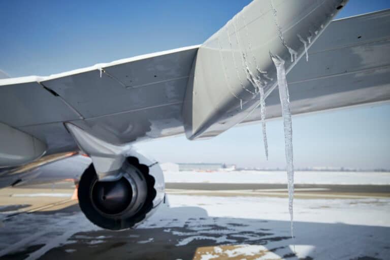
AIRMET Zulu — Icing and Freezing Level
AIRMET Zulu describes moderate icing and provides freezing-level information. For a piston single without FIKI certification, AIRMET Zulu on your route is a hard input. You fly below the freezing level. Or above the icing top. Or you file IFR to descend into warmer air. Or you don’t go.
The freezing-level data alone is one of the most useful pieces of information you’ll pull off a graphical AIRMET. It tells you where the air gets cold enough to support icing if visible moisture is present. Our structural icing guide walks through using the freezing-level number. The point is to plan an escape altitude before the wing accretes ice.
The Area Coverage Threshold Most Pilots Don’t Know
An AIRMET item is considered widespread for a reason. It must affect, or be forecast to affect, at least 3,000 square miles at any one time. That’s a tile roughly 55 nautical miles on a side.
The point of this threshold is the size signal. Conditions over a smaller area can still hit AIRMET-level intensity. You might not see an AIRMET at all. You might see a PIREP, a Center Weather Advisory, or nothing in the formal product chain. Reading AIRMETs and SIGMETs without grasping the area coverage threshold has a cost. Pilots assume “no AIRMET” means “no hazard.” It doesn’t. It means “no hazard at scale.”
Why That Matters in the Cockpit
Here’s what most pilots get wrong. They see a G-AIRMET zone on ForeFlight, route just clipping the edge, and decide they’re fine. The 3,000-square-mile floor means the forecaster only drew a boundary where they were confident at scale. Conditions on the boundary edge are real. Conditions just outside the boundary may still be hazardous in spots.
Treat the AIRMET boundary as a soft edge, not a fence. PIREPs on either side of the line tell you more about the actual weather than the line itself.
What a SIGMET Actually Is
SIGMET stands for Significant Meteorological Information. Per AIM 7-1-6, a SIGMET is a concise description of weather phenomena. The phenomena must be expected to affect the safety of aircraft operations. All aircraft, not just light singles.
SIGMETs are unscheduled products. They’re issued by the responsible Meteorological Watch Office as soon as it’s practical to alert operators and aircrews. Standard SIGMETs are valid for 4 hours. SIGMETs associated with tropical cyclones and volcanic ash clouds are valid for 6 hours. Unscheduled updates and corrections get issued as needed.
Reading AIRMETs and SIGMETs side by side, the difference shows up in intensity, area, and who they’re written for. A SIGMET is the higher tier.
The Four Non-Convective SIGMET Triggers in the Contiguous U.S.
Over the contiguous U.S., non-convective SIGMETs are issued when one of four phenomena occurs or is forecast:
- Severe icing not associated with thunderstorms
- Severe or extreme turbulence or clear air turbulence (CAT) not associated with thunderstorms
- Widespread dust storms or sandstorms lowering surface visibilities below 3 miles
- Volcanic ash
Note what’s missing from that list: thunderstorms. Thunderstorm hazards in the lower 48 get their own product, the Convective SIGMET.
How SIGMETs Are Named
SIGMETs over the contiguous U.S. carry an alphabetic designator from November through Yankee, excluding Sierra and Tango. That exclusion is on purpose — Sierra and Tango are the AIRMET letters, so the convention prevents confusion on a brief.
Issuance for the same phenomenon stays sequentially numbered using the original designator until the phenomenon ends. SIGMET Romeo 2, in the example from AIM 7-1-6, means it’s the second issuance of the Romeo-designated phenomenon.

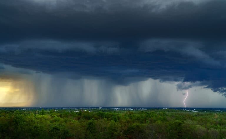
Convective SIGMET — The One You Treat as a Go/No-Go Gate
Convective SIGMETs are a separate product specifically for thunderstorm hazards. They’re issued for the western (W), central (C), and eastern (E) United States. The country gets split at 87 and 107 degrees west longitude. Bulletins are issued hourly at H+55. The forecast inside is valid for up to 2 hours.
Reading AIRMETs and SIGMETs in a thunderstorm setup means the Convective SIGMET is the document you read first.
The Convective SIGMET Trigger Criteria
A Convective SIGMET is issued for any of the following:
- Severe thunderstorm with surface winds 50 knots or greater
- Severe thunderstorm with surface hail 3/4 inch or larger
- Severe thunderstorm with tornadoes
- Embedded thunderstorms
- A line of thunderstorms
- Thunderstorms producing heavy or greater precipitation affecting 40% or more of an area at least 3,000 square miles
The last criterion is the one that catches single-pilot IFR plans. A summer afternoon line in the southeast may not be severe per cell. But the area coverage threshold puts the whole route under a Convective SIGMET.
What a Convective SIGMET Implies Automatically
This is the part many pilots miss. Per AIM 7-1-6, any Convective SIGMET implies severe or greater turbulence, severe icing, and low-level wind shear — automatically. You don’t get a separate SIGMET for those hazards inside a Convective SIGMET area. They’re baked in.
That implication clause drives the standard guidance. Stand off 20 nautical miles from any thunderstorm cell. Add another 20 NM between cells when picking through a gap. Our thunderstorm avoidance guide walks through the geometry. The Convective SIGMET is the signal that those distances are now required, not optional.
How to Decode the Text Bulletin in 60 Seconds
The text format of a SIGMET or Convective SIGMET looks like noise on first read. It isn’t. Once you know the structure, you can pull the actionable data in under a minute.
Here’s the AIM example for a non-convective SIGMET:
BOSR WS 050600
SIGMET ROMEO 2 VALID UNTIL 051000
ME NH VT
FROM CAR TO YSJ TO CON TO MPV TO CAR
OCNL SEV TURB BLW 080 EXP DUE TO STG NWLY FLOW.
CONDS CONTG BYD 1000Z.
What Each Line Tells You
Line by line: BOSR is the Boston MWO area, WS 050600 is the issuance date-time (5th of the month, 0600 UTC). SIGMET ROMEO 2 is the designator and sequence. VALID UNTIL 051000 is the 4-hour expiration. ME NH VT lists the states under the advisory. FROM CAR TO YSJ TO CON TO MPV TO CAR is the area outline, defined by VOR or airport identifiers. OCNL SEV TURB BLW 080 means occasional severe turbulence below 8,000 feet MSL. EXP DUE TO STG NWLY FLOW is the cause — expected due to strong northwesterly flow. CONDS CONTG BYD 1000Z says conditions are expected to continue beyond the 1000Z expiration.
Reading AIRMETs and SIGMETs cleanly is a skill. Once you’ve decoded a dozen of them, the format becomes a glance-and-go. The shorthand is built for radio readback by Flight Watch and FSS, not for casual reading. But it’s not hard.

How to Pull AIRMETs and SIGMETs in the Cockpit
You’ll see AIRMETs and SIGMETs through three primary sources in flight. Tablet EFB pulling data over ADS-B In. Panel-mount unit with FIS-B reception. Flight Watch and FSS over voice radio.
On a Tablet with ADS-B In
ForeFlight and Garmin Pilot both display AIRMETs and SIGMETs as overlays on the map. AIRMETs render as colored polygons keyed by hazard type. Pink for mountain obscuration. Purple for IFR. Orange or red for turbulence. Dark blue for icing. SIGMETs and Convective SIGMETs render as hatched polygons with text callouts.
Our ForeFlight complete pilot guide walks through enabling the overlays. It also covers toggling between the text bulletin and the graphical view. The key setting: turn on G-AIRMET, not just legacy text AIRMET. That’s what gives you the discrete 3-hour snapshots out to 12 hours.
On FIS-B
Per AIM 7-1-6, AIRMETs over the contiguous U.S. are broadcast on the Flight Information Service-Broadcast (FIS-B). Have a panel-mount with 978 MHz UAT receive? Or an ADS-B In portable like a Stratus or Sentry feeding your tablet? You’re getting AIRMETs in real time without a subscription.
SIGMETs and Convective SIGMETs broadcast on FIS-B as well. The data refresh is fast, and the coverage is national. There’s no excuse to take off without these overlays enabled.
Over Voice on Flight Watch and FSS
When the tablet dies or the data feed drops, voice still works. Call Flight Service on 122.2 or the appropriate Flight Watch RCO. Ask for “in-flight weather advisories for my route.” A briefer will read out current AIRMETs and SIGMETs that affect you. Use the 1-800-WX-BRIEF number on the ground for the same thing.
This is the fallback every IFR pilot should rehearse. The day the iPad overheats and shuts down is not the day to learn this. Rehearse the SIGMET update request over the radio when nothing is wrong.
G-AIRMET — The Graphical Version You Should Use
Reading AIRMETs and SIGMETs in 2026 means leaning on graphical AIRMETs as the modern preferred format. They show terrain (Sierra), turbulence (Tango), and icing (Zulu) hazards as boundaries on a chart. Details boxes carry the altitude range and cause.
G-AIRMETs over the contiguous U.S. are valid at discrete times no more than 3 hours apart, for a period of up to 12 hours into the future. So you get a 00-hour snapshot for current conditions, then 03, 06, 09, and 12-hour forecasts. Additional snapshots may insert during the first 6 hours.
The Interpolation Trap
Honestly, this is where we’d push back on how G-AIRMETs are typically taught. AIM 7-1-6 spells out an interpolation rule most flight instructors skip. If the 00-hour shows no hazard and the 03-hour shows hazard, assume the hazard exists from 0001 to 0559. The 06-hour returning to clean does not change that read. The snapshots are not the only times the hazard is present. The snapshots are not the only times the hazard is present.
The takeaway: a clean 00-hour does not mean a clean next 3 hours. If the 03-hour shows AIRMET Zulu icing along your route, the icing layer may already be forming at hour 1. Plan as if the hazard is continuous between snapshots unless the bulletin says otherwise.
Center Weather Advisory — The Product That Fills the Gap
The Center Weather Advisory (CWA) is the fourth inflight advisory product, alongside AIRMETs and SIGMETs. CWAs are unscheduled, short-lead-time advisories issued by ARTCC Center Weather Service Units. They cover phenomena that don’t yet meet SIGMET or AIRMET criteria. But ATC needs pilots to know about them in the next two hours.
CWAs are useful for two scenarios. First, as a supplement to an existing SIGMET or AIRMET when conditions intensify locally. Second, as the only advisory when developing weather doesn’t quite hit AIRMET thresholds. Pilot reports are stacking up and a CWA is the formal channel. If you fly the same ARTCC sector frequently, CWAs are worth pulling up alongside the standard advisories.
Common Mistakes Pilots Make Reading AIRMETs and SIGMETs
Reading AIRMETs and SIGMETs cleanly is a skill that accident reports test in public. Five mistakes show up across accident reports, NTSB safety summaries, and PilotWorkshops debrief content. Avoid them and your weather decision-making improves immediately.
Mistake 1: Treating AIRMET Sierra as a non-event. Sierra means IFR or extensive mountain obscuration over a real area. For a VFR pilot, that’s stop. For an IFR pilot, that’s plan the alternate hard.
Mistake 2: Confusing AIRMET Zulu with “no ice.” Zulu means moderate icing is forecast. Severe icing skips Zulu and goes straight to a SIGMET. The absence of a Zulu doesn’t mean there’s no icing — it means there’s no widespread moderate icing forecast.
Mistake 3: Ignoring the 3,000-square-mile area floor. Hazardous weather under the area threshold still exists. PIREPs and CWAs are where you’ll catch it.
Mistake 4: Reading the 00-hour G-AIRMET and stopping there. The 03, 06, 09, and 12-hour forecasts are part of the same product. Read all of them along your route timeline.
Mistake 5: Missing the Convective SIGMET implication clause. Severe turbulence, severe icing, and low-level wind shear are automatic inside a Convective SIGMET area. You don’t need a separate SIGMET to know the hazards are there.
How to Build a Pre-Flight Routine That Catches Both Products
A consistent pre-flight routine for reading AIRMETs and SIGMETs takes about five minutes. Three steps make it bulletproof.
First, pull the text AIRMET bulletin for your AWC region. Scan for Sierra, Tango, and Zulu lines along your route. Note the freezing level number and any 30-knot surface wind callouts.
Second, pull the G-AIRMET graphic for 00, 03, and 06 hours covering your planned departure and en route time. Look for boundary changes between snapshots that intersect your route or alternates.
Third, pull active SIGMETs and Convective SIGMETs for your route. If anything sits along your line of flight or your alternate, the answer changes. Either reroute around, delay, or scrub. The advisory exists because the forecaster is confident the hazard is real and ATC needs the traffic to know.
This is the routine we’d hand a brand-new instrument pilot on day one. It’s the same routine a 4,000-hour CFII runs on a Tuesday afternoon flight. The skill of reading AIRMETs and SIGMETs is mostly the discipline of doing it every time.
Our Take on Reading AIRMETs and SIGMETs
Here’s our take. The pilots who get into weather trouble rarely missed a SIGMET. They saw it, decided it was on the edge of their route, and pressed. The pilots who stay out of trouble treat the overlay differently. They use it as the first input to a no-go conversation, not the last.
If you fly the E3 way, you brief these products on every flight. Every front, every moisture line, every terrain crossing. You ask Flight Watch for an update mid-flight. You write down the freezing level next to your altitudes. The advisories are not paperwork. They’re the FAA telling you exactly where the hazard is and how long it’s expected to last.
Our E3 community has dozens of CFIIs and weather-trained pilots. They’d love to walk you through your last go/no-go call. Bring your SkyVector route, your most recent G-AIRMET screenshot, and a real question. That’s how the habit of reading AIRMETs and SIGMETs becomes muscle memory.
Frequently Asked Questions About Reading AIRMETs and SIGMETs
The three questions GA pilots ask most about reading AIRMETs and SIGMETs, answered straight.
How long is a SIGMET valid?
A standard SIGMET is valid for 4 hours. SIGMETs associated with tropical cyclones and volcanic ash are valid for 6 hours. Convective SIGMETs are issued hourly at H+55 with a forecast valid for up to 2 hours. AIRMETs in the contiguous U.S. are issued every 6 hours at 0245, 0845, 1445, and 2045 UTC. The validity window is part of the bulletin header and worth reading first.
What’s the difference between an AIRMET and a Convective SIGMET?
An AIRMET covers moderate-intensity hazards — IFR, moderate turbulence, moderate icing, mountain obscuration, freezing levels, and strong surface winds. A Convective SIGMET covers thunderstorm hazards specifically. Any Convective SIGMET implies severe turbulence, severe icing, and low-level wind shear automatically. The two products don’t overlap. Thunderstorm hazards never appear in an AIRMET in the lower 48.
Can a flight be legal under an AIRMET Zulu?
Yes, legally — AIRMET Zulu doesn’t ground anyone by regulation. But for a piston single without FIKI certification, flying into known moderate icing is poor airmanship. It can trigger an FAA enforcement question if an incident follows. The FAA expects pilots to use AIRMET Zulu as part of a risk assessment. Pilots who fly into forecast moderate icing in a non-FIKI aircraft are not flying the expected way. Insurance carriers and the agency both notice.
Further Reading from E3 Aviation
Pair this guide with our other weather and planning pieces:
- Thunderstorm Avoidance: The Complete GA Pilot Guide 2026
- Structural Icing in Piston Singles: A 2026 GA Pilot Guide
- ForeFlight Complete Guide for GA Pilots (2026)
- How to File a VFR Flight Plan: A GA Pilot 2026 Guide
- Density Altitude: The Complete GA Pilot Guide for 2026
- Holding Pattern Entry: Direct, Teardrop, Parallel
- IFR Currency Requirements: The Complete 2026 GA Guide
External Authority References
- FAA AIM 7-1-6 Inflight Aviation Weather Advisories
- Aviation Weather Center — AIRMETs
- Aviation Weather Center — SIGMETs and Convective SIGMETs
- NWS Reference — What is an AIRMET

